- Izu Peninsula top
- General
- Earthquake and volcano
- Too many deer in Izu
- East
- Ito - its old buildings
- Anjin = Wlliam Adams and Ito
- Religious Charisma Nichiren
- Washtub race
- Yokikan - Spa ryokan
- Minami-Kaikisen: Auberge
- Ike and its paddy fields
- Summer has come!!!
- Inatori - fish, spa and more
- Central
- Banjo Waterfall
- Mount Amagi
- Shuzenji - old spa town
- Arabashiri - Bandai-Jozo
- Oomi Land - heart of Izu
- West and south
- Heda on the west coast
- Toi - Gold mine
- Matsuzaki - namako wall
- Izu-no-Chohachi - Plasterer
- Kumomi on the west coast
- Shimoda - Tojin-Okichi
- Cottage life
- Fishing in Usami
- Start of my fishing life
- Training camp in Amagi
- Cottage life / music&drinks
- Party in Izu - part 2
- Party in Izu - part 1
- Sunday morning concert
- Ice and snow in Amagi
- My summer house
- Restaurant and eatery
- Let’s eat Izu-Deer!
- Isui-an - exquisite soba
- Sugizen - big prawn fry
- Sayang - Bali restaurant
- Restaurant Tanaka


Climbing up Mount Amagi - Mt. Banjirodake and Mt. Banzaburodake
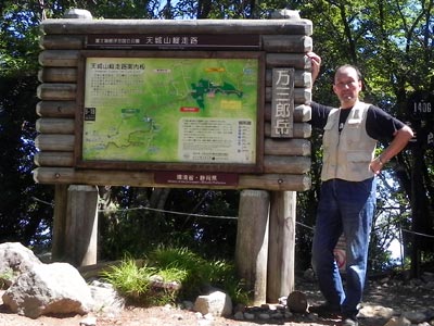
The weather was extremely fine in the second week of July and I decided to climb up Mount Amagi. We usually say Mount Amagi, but it is in reality a range of mountains and its highest peak is Mt. Banzaburodake (1,406m) and the second highest peak is Mt. Banjirodake (1,299m).

Overview of the hiking course - I started from Amagikogen Golf Course, went through Yotsuji up to Mt. Banjirodake and then to Mt. Banzaburodake. On the way back, I took a different course which went down from Mt. Banzaburodake to Karasawa Junction and then to Yotsuji.
A wooden sign indicating the peak of Mt. Banirodake
![]() The hiking course begins at the entrance of Amagikogen Golf Course (1,050m above sea level). I started at 7:19 in the fresh morning air. At the beginning the course was not much pleasant as it went through planted coniferous forest of cedar and cypress. After about 15 minutes walk there was a junction. I chose the left path and went up Mt. Banjirodake first. After the junction, the landscape turned to be lighter and friendlier because the path started to go through natural forest and I could enjoy many kinds of deciduous trees and grasses and occasionally distant views through woods.
The hiking course begins at the entrance of Amagikogen Golf Course (1,050m above sea level). I started at 7:19 in the fresh morning air. At the beginning the course was not much pleasant as it went through planted coniferous forest of cedar and cypress. After about 15 minutes walk there was a junction. I chose the left path and went up Mt. Banjirodake first. After the junction, the landscape turned to be lighter and friendlier because the path started to go through natural forest and I could enjoy many kinds of deciduous trees and grasses and occasionally distant views through woods.
![]() I reached the peak of Mt. Banjirodake at 8:13. The peak area of Mt. Banjirodake was thickly covered by woods and I could not have a good view. Therefore, I walked further without taking rest. After walking down a slope for ten minutes or so, I found a large rock with a good view to the peaks I was heading for. This part of the route appeared to be a haven of butterfly.
I reached the peak of Mt. Banjirodake at 8:13. The peak area of Mt. Banjirodake was thickly covered by woods and I could not have a good view. Therefore, I walked further without taking rest. After walking down a slope for ten minutes or so, I found a large rock with a good view to the peaks I was heading for. This part of the route appeared to be a haven of butterfly.  I was always accompanied by tens of butterflies who were presumably surprised by my walking noise and took off from their rest and fluttered around me.
Between Mt. Banjirodake and Mt. Banzarurodake, the path follows the ridge and though there were a few cols, the course was in general flat and surrounded by typical trees and shrubs of Amagi. That was the most pleasant part of the hiking. After passing through a saddle, I came to Umanose. "Umanose" means "horse back" and it is a spot on the ridge with a good view to the sea and Mt. Banjirodake.
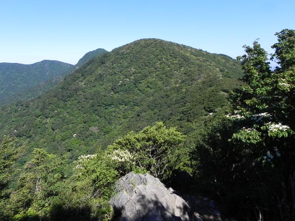
Umanose and Mt. Banzaburodake seen from the down slope from Mt. Banjirodake
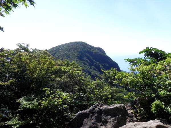
Mt. Banjirodake seen from Umanose
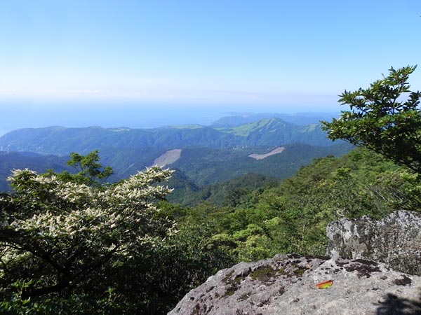
Sea view from Umanose
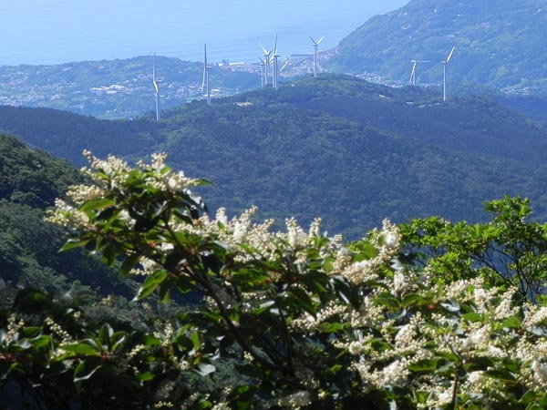
A group of windmills on Mt. Tenmokuzan near Atagawa. They stopped rotating as there was no wind.
A part of Amagikogen Golf Course was seen from the path. The nearest holes were the 16th short hole on the right side and the 17th long hole on the left side of the photo below. From the tee ground of the 17th hole, Mt. Fuji can be beautifully seen in the direction to the green when the weather is fine. I used to play on this course, but gave up golfing several years ago due to trouble with my hip joint. However, the view of the beautiful course tempted me to resume golfing.
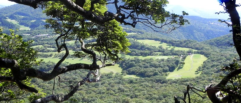
Amagikogen Golf Course - A part of in-course is seen on this photo.
At this part of the course hikers can enjoy a long "tunnel of Asebi". "Asebi" is a bushy evergreen tree that grows in the south of Japan. It looks beautiful with tiny white flowers in the spring. However, it is poisonous. The name "Asebi" means "Drunken Horse Tree" and this indicates that even a horse suffers from the poison if it eats Asebi and walks as if it is drunk. As I reported in another article, there are nowadays too many deer in Amagi. But, they know that Asebi is poisonous and do not eat it. As a result poisonous trees more and more prosper in the mountains.
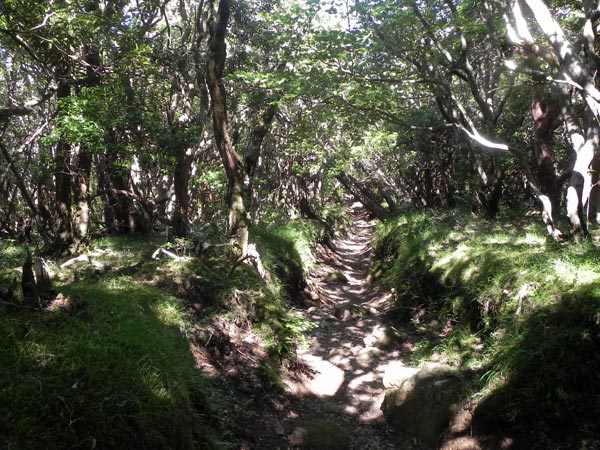
Tunnel of Asebi

Path on the ridge was really pleasant to walk
I had to descend further to reach the lowest point between two peaks. The saddle is called "Hanadate". The name indicates that the area is abundant with rhododendron. The species is endemic to Amagi. Unfortunately flowering season is May and June and I could not enjoy rhododendron blossoms.
From the slope before Mt. Banzaburodake I could see Amagi Harvest Club, a resort hotel near my cottage, the town of Ito and Hatsushima Island. These days the weather report warned the risk of heat stroke for most part of Japan because of extremely high temperature. The highest temperature in Tokyo on this day was 35℃ degree and maybe the temperature of Ito must have been very high though not so high as in Tokyo. However, high on the mountains, temperature was under 30℃ degree. It was hot, but comfortable and I could enjoy fresh breeze in the shade of trees. It was a heavenly experience.
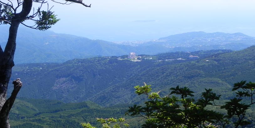
Tokyu Harvest Club, town of Ito and Hatsushima Island
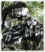
Sign on Mt. Banzaburodake. It is the evidence that I reached the highest peak of Mount Amagi.
I reached Mt. Banzaburodake at 9:28 and took photos as evidence that I was there.
It was a surprise that I met only ONE old couple on the way to the peak, maybe because it was a weekday and schools did not break up for summer holidays yet. A famous writer Fukada Kyuya (1903-1971) 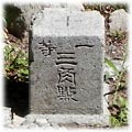 selected 100 celebrated mountains in his essays in 1964 and Mt. Banzaburodake (Mt. Amagi) was included in the list. Therefore, Amagi is often crowded with hikers.
It seems worth trying to walk along the ridge from Mt. Banjirodake through Mt. Banzaburodake to Hatchoike pond which is located near the Amagi Mountain Pass. However, hikers need to arrange transportation both to the start place and from the goal as the possibility of public transport is very limited. Therefore, I chose a round route today.
I took another route for returning to the starting point, as I thought it might be dull to follow the same path. This seemed to be a right decision at the beginning. I could enjoy many huge Japanese beech trees. Beech forest is appreciated in Japan, maybe because beech is a magnificent tree and everybody can feel the great power of nature in beech forest. Mount Amagi is famous for its beech trees and I could see many of them around the peak of Mt. Banzaburodake. I could also clearly see Mt. Fuji, which is located some 60 km northwards from Mt. Amagi.
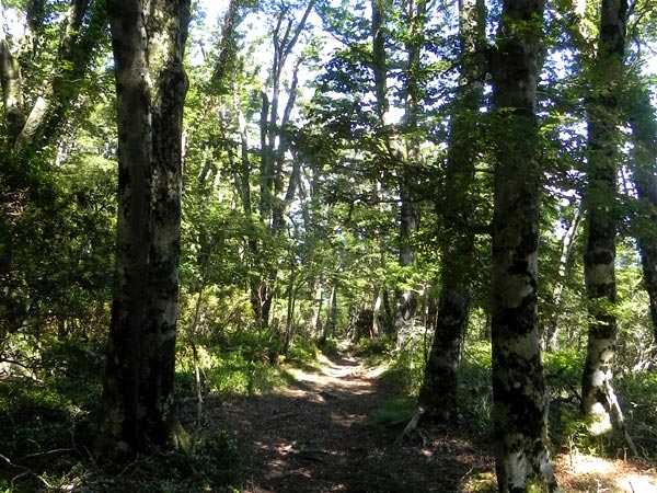
Path goes through the forest of Japanese beech.
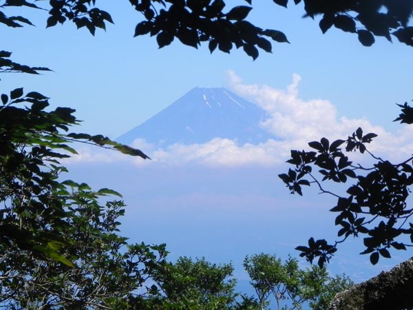
Mt. Fuji was seen through twigs and leaves.
The route between Karasawa Junction and Yotsuji was dark and gloomy.
After beach forest, the path went down steeply and suddenly I was attacked by enormous swarms of flies. I was annoyed by flies till I descended steeply some four hundred meters and reached Karasawa Junction at 10:14 from where the pass went more or less horizontally on the northern slope of the mountains.
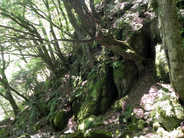
I came to regret my decision not to go back the same route, because the environment was there not much pleasant between Karasawa Junction and Yotsuji. It was dark and gloomy and the route was damaged at several places. I had to hold a rope attached to the rock so as not to fall down from the half broken path.
Anyhow, I managed to return to the starting point at 11:44. Distance was 7,4 km and hight diffrence was 356m. The hiking lasted 4 hours and 25 minutes. I was exhausted, but happy.